My Dalton Highway Adventure
In late June I packed up the adventure-mobile and left Anchorage to drive the haul road up to Prudhoe Bay. I left mid-afternoon on Monday, June 26, 2017, and spent the first night camped at Sourdough Creek, just off the Richardson Highway. The road was under cloud cover a great deal of the way up, until well after Fairbanks, and so the photos start along the haul road. Be forewarned: many photos of mountains and clouds ahead!
As always: clicken to embiggen.
Here's the whole route, out the Richardson and back down the Parks Highway:


I crossed the Arctic Circle around 8:00 PM June 27, 2017. The sun was at my back, so I'll be sure to get a better shot as I cross again on the way back.


After an early start, a quick photo at Grayling Lake around 6:00AM.

Then into Coldfoot Camp for breakfast (we'll see more from here on the way back - again, for breakfast!)

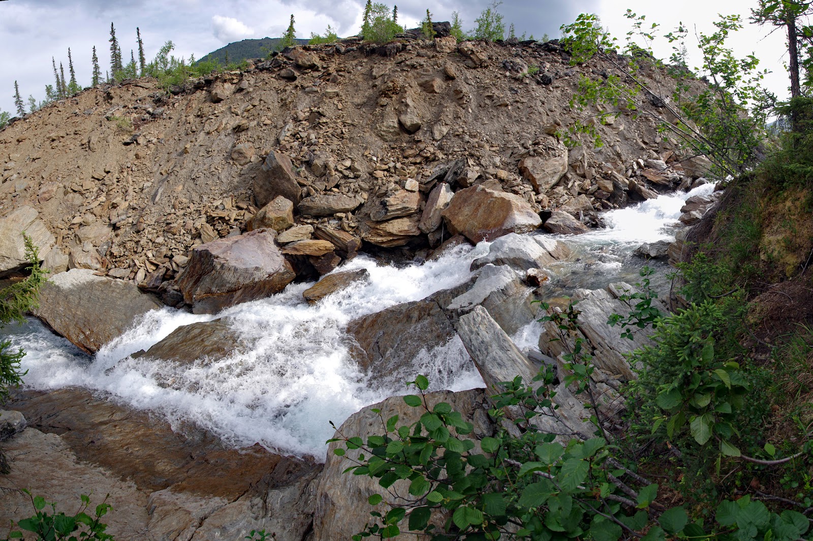
Just a few miles north of Coldfoot, I stopped to spend the day at Marion Creek, and to hike out to see the falls.
A horseshoe bend along Marion Creek.

Part of the woods was covered in this low, snow like lichen.


The trail joins a service road for a bit, until this marker shows you where you get off the road and back on the trail again.

And then, before you know it, you're at the falls!


A view from the trail back.

And then, minutes after I got back to the adventure-mobile, this happened.
But it blew over after a few minutes and I was able to make camp for the day.
Birdy McBirdface was not impressed by my camp!

The next morning, I stopped by the Middle Fork, Koyukuk River, near Wiseman.

Mountains & clouds...

Roadside panorama along the Atigun Pass.

Taking a break along the Atigun River.


Another roadside panorama.

Drove all the way up to Galbraith to camp for the night.


And tried making my first time-lapse videos.
Pump Station #3.

And, we're in the tundra now!


A little ways south of Deadhorse, there were some caribou off the road a ways.


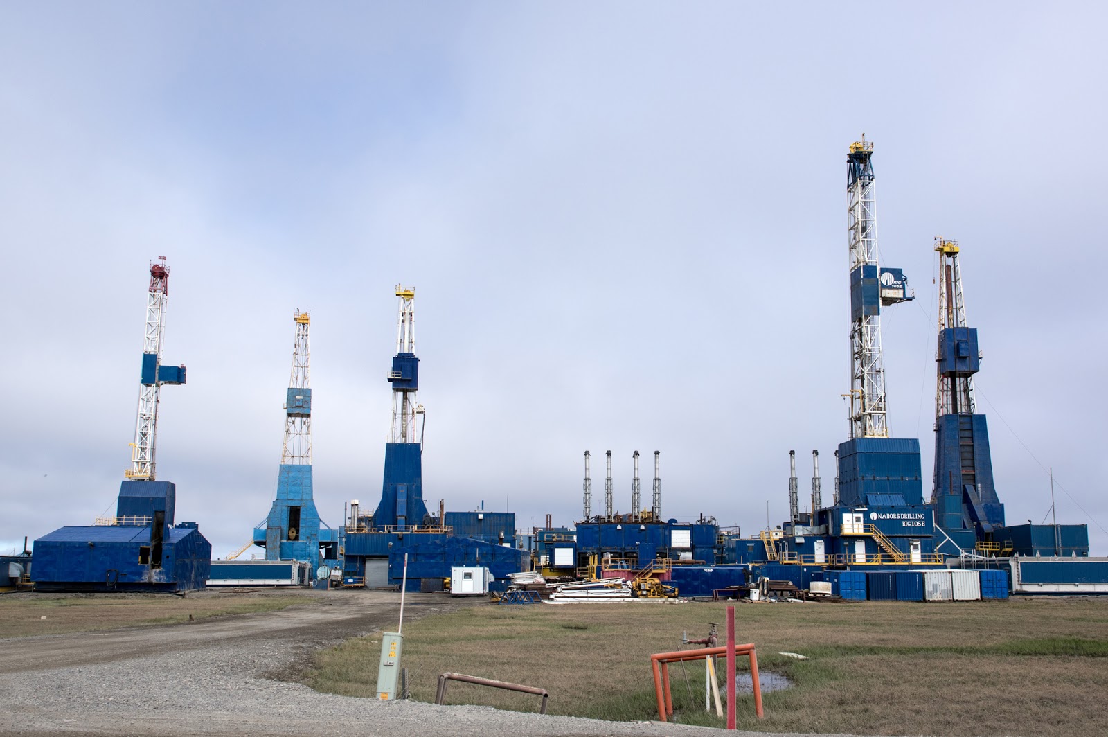
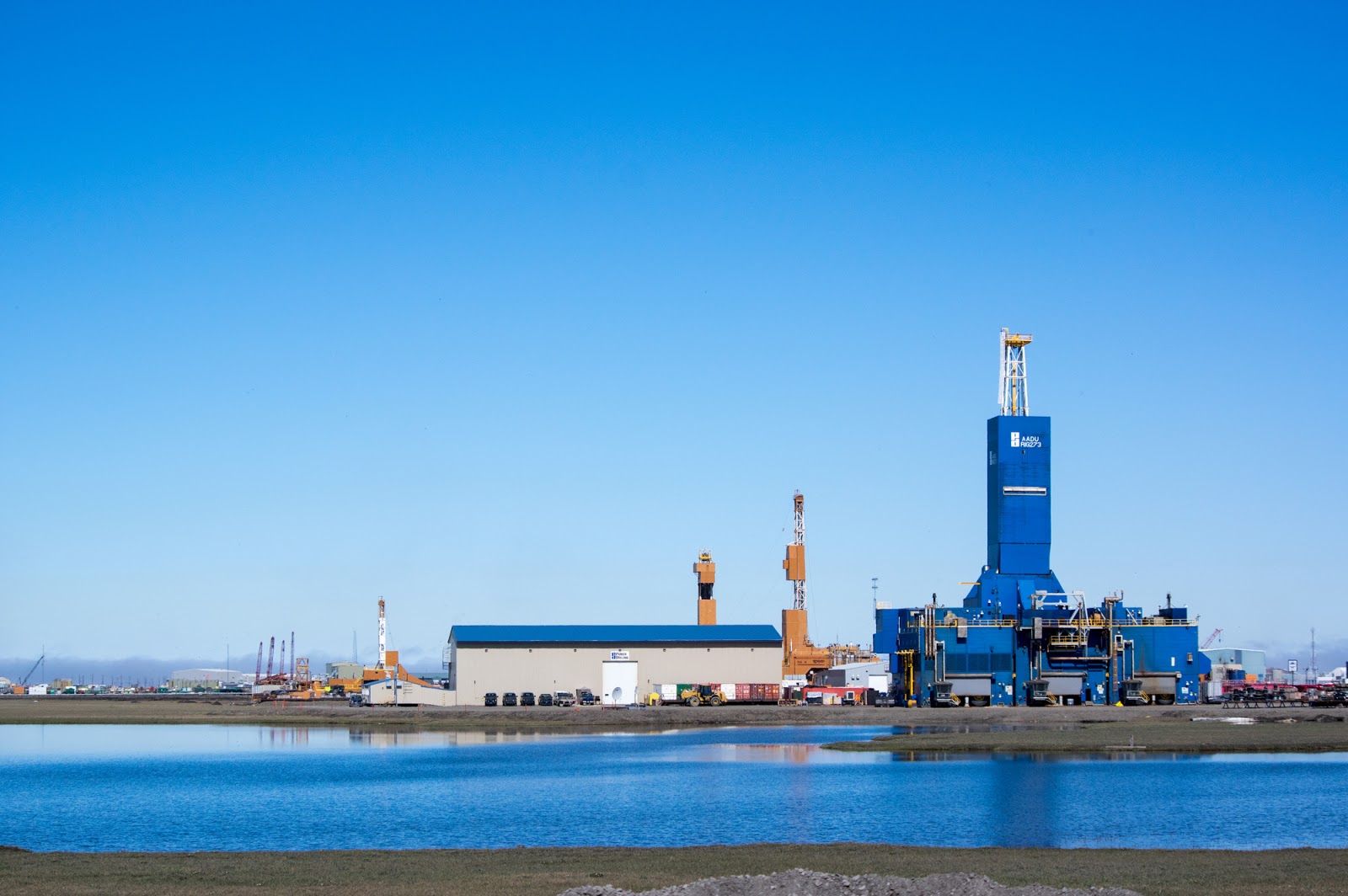
I got into Prudhoe Bay in the early afternoon and was lucky enough to obtain a room at the world famous Aurora Hotel.

This place really is an amazing operation. More on that later.
To keep the place clean, there are booties they ask you put booties on in the arctic entries.


It seems that they had had an unruly visitor the week prior.

These next few photos are taken through bus windows as we toured through Prudhoe Bay and onto the Arctic Ocean.


The first well head!


Pilot flames.


These little green boxes are actually the wells.


And this is where the tour bus stopped.

To let us explore the Arctic Ocean from this little spit.

It takes a powerful squint to face the Arctic Sun!

And, of course, I collected samples!


Some geese flew by on the way back.

The Aurora Hotel caters mainly to oil company personal. Meals are included in you room cost. There's a large buffet/cafeteria that serves three meals daily as well as a very well provisioned "grab and go" area to pack together meals to take for long/swing shift lunches. Additionally, there are also snack and beverage stations on each floor and huge laundry facilities (no additional charge and with automatic soap). Truly a haven for the weary traveler!
After a restful night's sleep, and with a full belly and re-provisioned supplies, it was time to make my final exploration of Prudhoe Bay before starting the long drive south.


More geese.


Ice wedge polygons.


Still more geese.

With little geeses.


Little guy hunting.


Hey look! Geese!


And I spent a while combing the banks of the Sagavanirktok (Sag) River before finally getting back on the road. The weather was nice, and the skies were clear, and I drove all the way to just outside Wiseman before pulling over to camp around 1:00 AM.

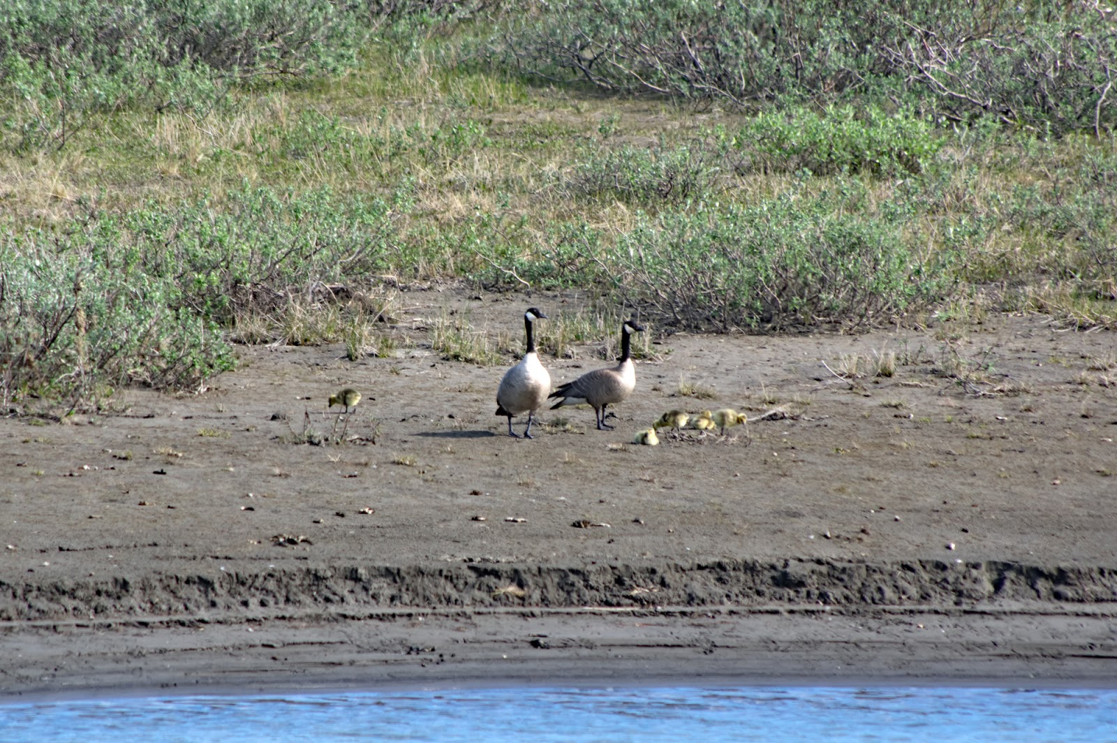
Some geese with babies.


Some views along the Sag River.


And some more Sag River geese.


Came across this guy perched roadside.


Then there was this one lone 'bou grazing the tundra.

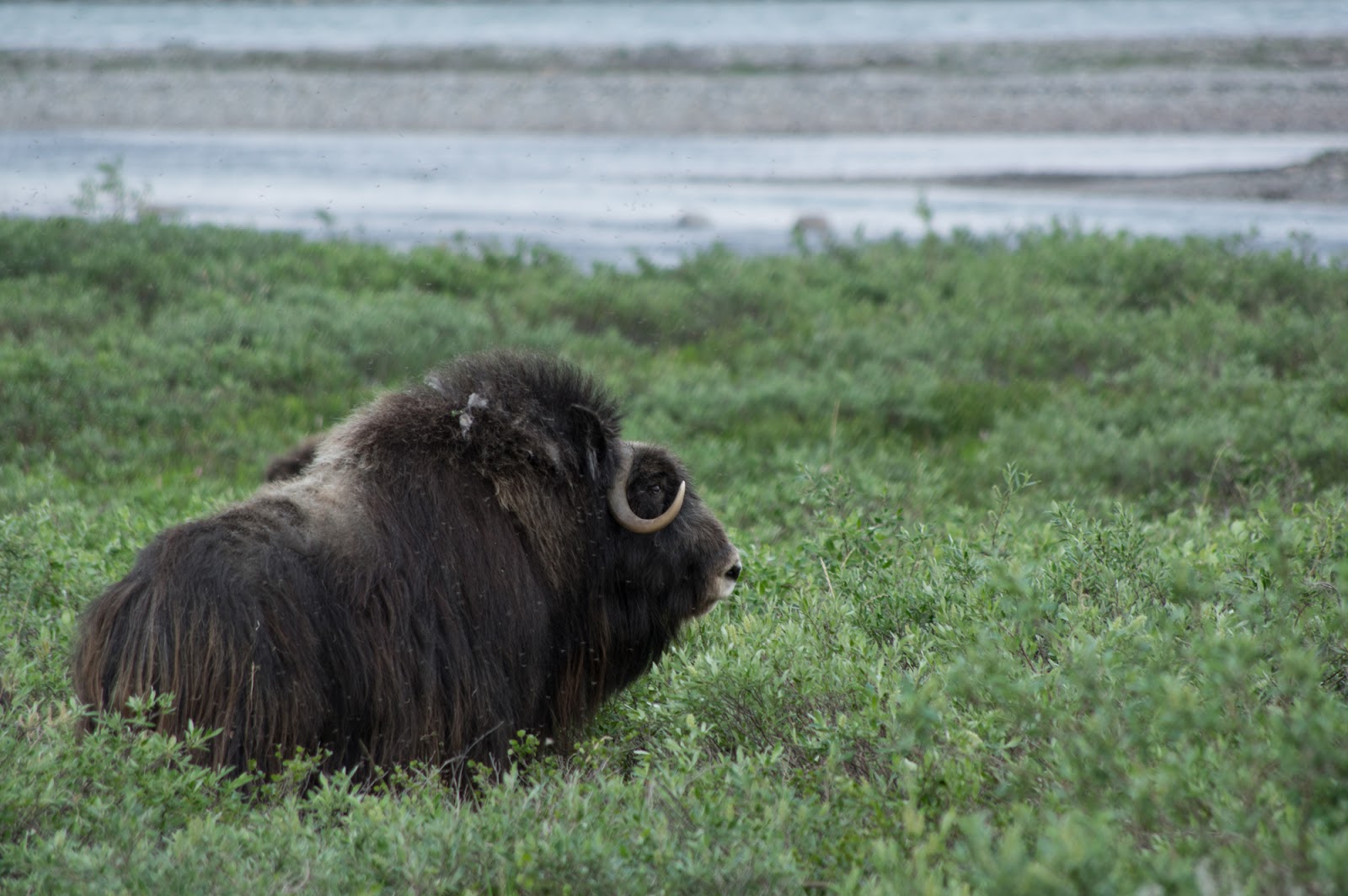
About an hour further down the road, a small herd of musk ox was browsing.


Some more pictures of mountains and clouds.


Roadside selfie, about 9:30 PM.


Scenic views from the drive south.


I realy wanted to explore along this road...


But these guys control all the cool roads!


This shot was taken just before midnight.


The view from where I camped just outside Wiseman, taken at 12:53 AM.

Back in Coldfoot for another tasty breakfast!


Ducks on a pond.

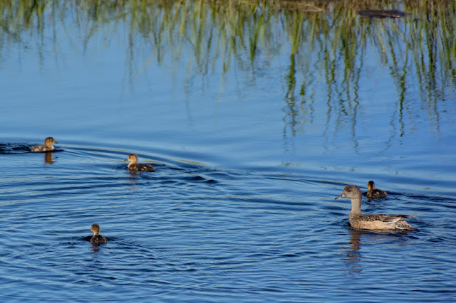

Quick! Everyone into the reeds!

Dad stands guard.

Back at the Arctic Circle. A curious grey jay perched on my camera while I was getting set-up, but took off once I started taking test shots.


The other side of the road from Finger Mountain.


I spent some time exploring side roads on the trip back, and found this area.


You find the most interesting things exploring service roads!


A roadside pond.

The Dalton Highway sign was packed with people taking photos on my way up, so I stopped to take my selfie with it on the way back.

My last campsite along the Tatalina River.


And so ends my big fat arctic adventure.

In late June I packed up the adventure-mobile and left Anchorage to drive the haul road up to Prudhoe Bay. I left mid-afternoon on Monday, June 26, 2017, and spent the first night camped at Sourdough Creek, just off the Richardson Highway. The road was under cloud cover a great deal of the way up, until well after Fairbanks, and so the photos start along the haul road. Be forewarned: many photos of mountains and clouds ahead!
As always: clicken to embiggen.
Here's the whole route, out the Richardson and back down the Parks Highway:
Here's a stand of birch right along the start of the Dalton Highway.

A turn-out where I stopped to stretch my legs:


And the world famous Finger Mountain!


I made camp that night along the banks of the Jim River.


Then into Coldfoot Camp for breakfast (we'll see more from here on the way back - again, for breakfast!)

A horseshoe bend along Marion Creek.

Part of the woods was covered in this low, snow like lichen.


A view from the trail.


And then, before you know it, you're at the falls!

Video of the falls on Marion Creek
A view from the trail back.

And then, minutes after I got back to the adventure-mobile, this happened.
Thunderstorm!
But it blew over after a few minutes and I was able to make camp for the day.
Birdy McBirdface was not impressed by my camp!

The next morning, I stopped by the Middle Fork, Koyukuk River, near Wiseman.

Mountains & clouds...

Roadside panorama along the Atigun Pass.

Taking a break along the Atigun River.


Another roadside panorama.

Drove all the way up to Galbraith to camp for the night.


And tried making my first time-lapse videos.
Back on the road the morning of June 30, 2017. I have an afternoon tour to the Arctic Ocean to catch, and 150 miles to cover.
Pump Station #3.

And, we're in the tundra now!


A little ways south of Deadhorse, there were some caribou off the road a ways.


I got into Prudhoe Bay in the early afternoon and was lucky enough to obtain a room at the world famous Aurora Hotel.

This place really is an amazing operation. More on that later.
To keep the place clean, there are booties they ask you put booties on in the arctic entries.


It seems that they had had an unruly visitor the week prior.

These next few photos are taken through bus windows as we toured through Prudhoe Bay and onto the Arctic Ocean.


The first well head!


Pilot flames.


These little green boxes are actually the wells.


And this is where the tour bus stopped.

To let us explore the Arctic Ocean from this little spit.

It takes a powerful squint to face the Arctic Sun!

And, of course, I collected samples!


The Arctic Ocean.
Some geese flew by on the way back.

The Aurora Hotel caters mainly to oil company personal. Meals are included in you room cost. There's a large buffet/cafeteria that serves three meals daily as well as a very well provisioned "grab and go" area to pack together meals to take for long/swing shift lunches. Additionally, there are also snack and beverage stations on each floor and huge laundry facilities (no additional charge and with automatic soap). Truly a haven for the weary traveler!
After a restful night's sleep, and with a full belly and re-provisioned supplies, it was time to make my final exploration of Prudhoe Bay before starting the long drive south.


More geese.


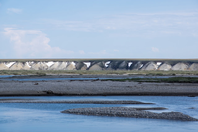
Ice wedge polygons.


Still more geese.

With little geeses.


Little guy hunting.


Hey look! Geese!


And I spent a while combing the banks of the Sagavanirktok (Sag) River before finally getting back on the road. The weather was nice, and the skies were clear, and I drove all the way to just outside Wiseman before pulling over to camp around 1:00 AM.

Some geese with babies.


Some views along the Sag River.


And some more Sag River geese.


Came across this guy perched roadside.


But he wasn't having any of this "candid camera" business!

Then there was this one lone 'bou grazing the tundra.

About an hour further down the road, a small herd of musk ox was browsing.


Some more pictures of mountains and clouds.


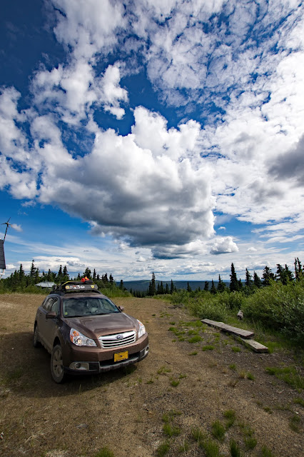
Roadside selfie, about 9:30 PM.


I realy wanted to explore along this road...


But these guys control all the cool roads!


This shot was taken just before midnight.


The view from where I camped just outside Wiseman, taken at 12:53 AM.

Back in Coldfoot for another tasty breakfast!


Ducks on a pond.


Quick! Everyone into the reeds!

Dad stands guard.

Back at the Arctic Circle. A curious grey jay perched on my camera while I was getting set-up, but took off once I started taking test shots.


A lake with no name south of the mighty Yukon River.

Kanuti Refuge.


The other side of the road from Finger Mountain.


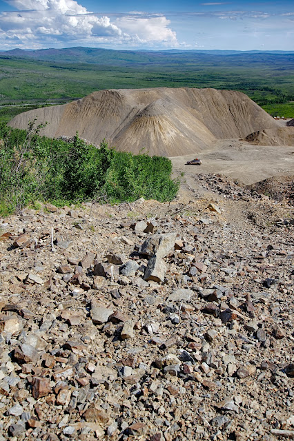
I spent some time exploring side roads on the trip back, and found this area.


Of course I'm going to have to see where this goes!


You find the most interesting things exploring service roads!


I wonder what's through these woods?


A roadside pond.

The Dalton Highway sign was packed with people taking photos on my way up, so I stopped to take my selfie with it on the way back.

My last campsite along the Tatalina River.


And so ends my big fat arctic adventure.
